Vintage Map of Nantucket Island And Town by Ruth Haviland Sutton, 1946


Vintage Map of Nantucket Island And Town by Ruth Haviland Sutton, 1946
$1,400.00
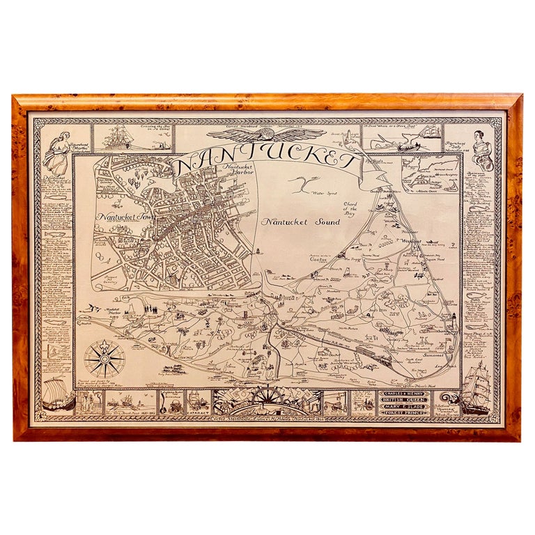
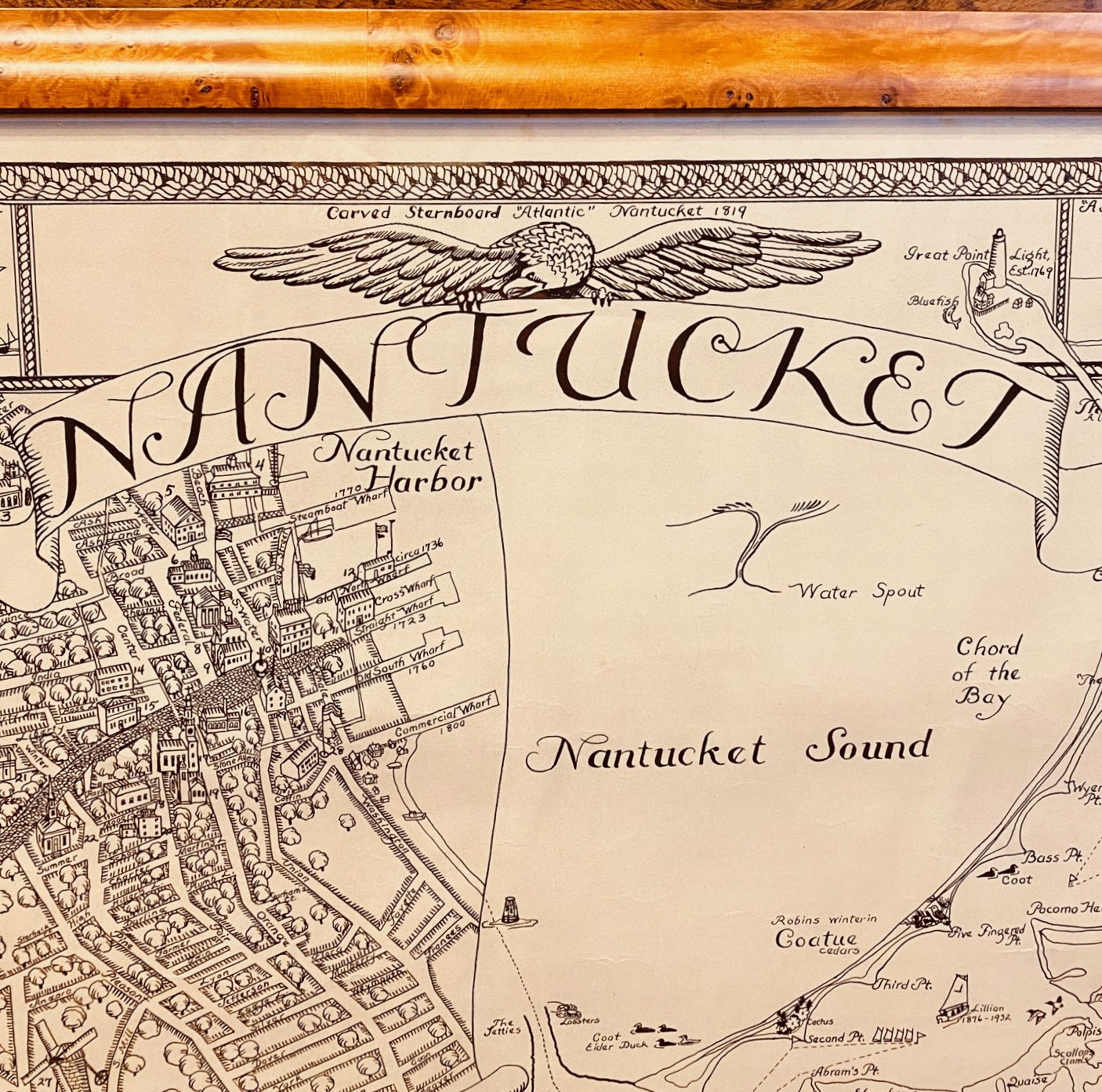
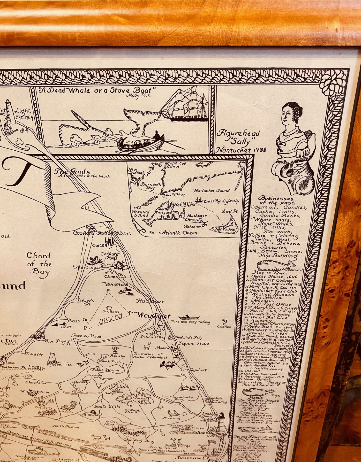
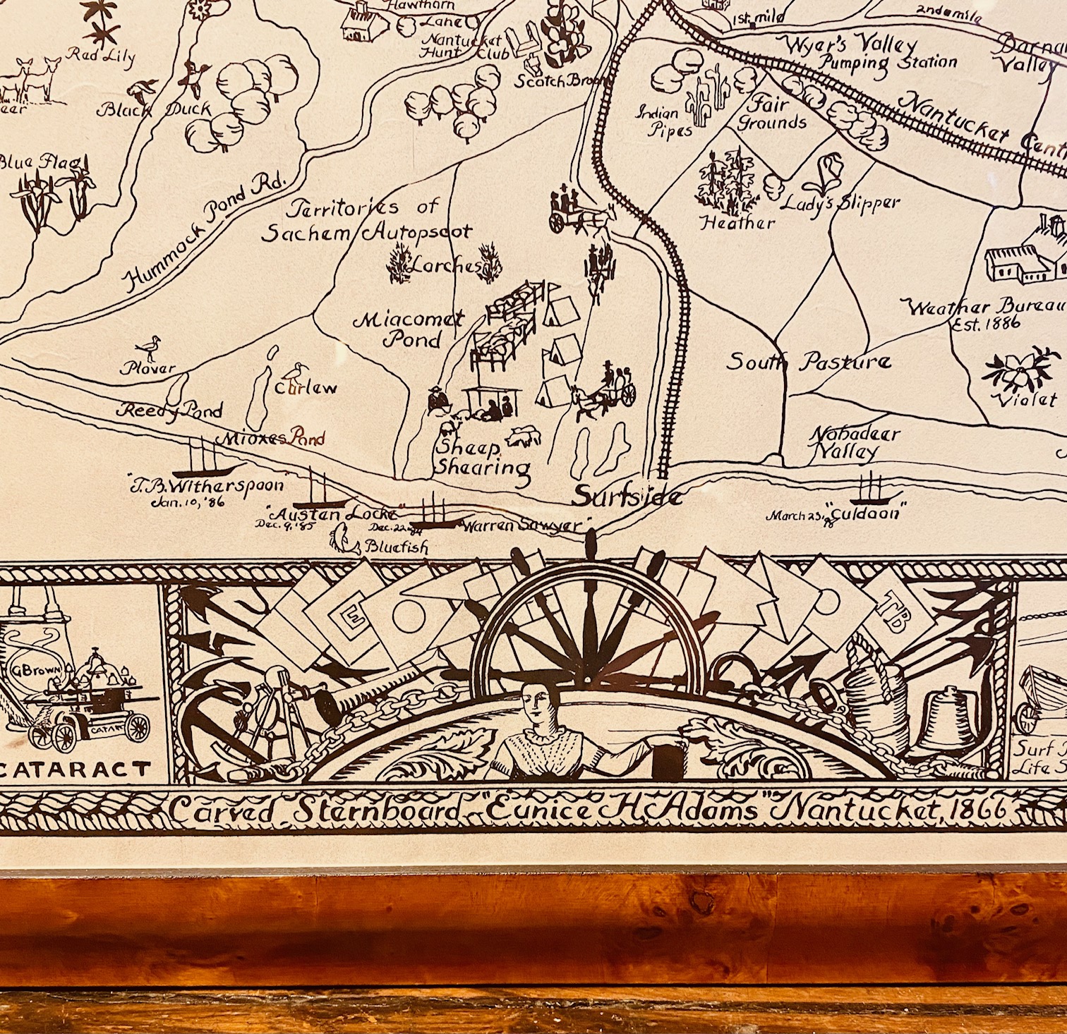
Vintage Map of Nantucket Island And Town by Ruth Haviland Sutton, 1946, a classic vintage tourist map of Nantucket Island showing historic landmarks and geographic details along with decorative images, and featuring an enlargement of Nantucket Town with street plan; the perimeter features a series of iconic images and factual notes from Nantucket’s history; signed in print lower left “Planned and Drawn by Ruth Haviland Sutton 1946, lithographed by George C. Miller.”
Out of stock
Vintage Map of Nantucket Island And Town by Ruth Haviland Sutton, 1946, a classic vintage tourist map of Nantucket Island showing historic landmarks and geographic details along with decorative images, and featuring an enlargement of Nantucket Town with street plan; the perimeter features a series of iconic images and factual notes from Nantucket’s history; signed in print lower left “Planned and Drawn by Ruth Haviland Sutton 1946, lithographed by George C. Miller.”
The map is in mint collection having been kept in archival storage since it was printed in the estate of Nantucket photographer and shop keeper Marshall Gardiner. It has been recently mounted and framed in a bird’s eye maple frame.
Measures: 22-3/4 in H x 31-3/4 in W
Framed: 25-1/4 in H x 34-1/8 in W