19th Century Chart of New England Coast: the U.S. Coast Survey Sketch A – Section 1

19th Century Chart of New England Coast: the U.S. Coast Survey Sketch A – Section 1
$1,400.00
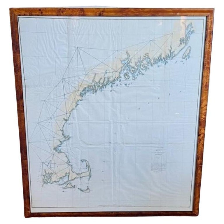
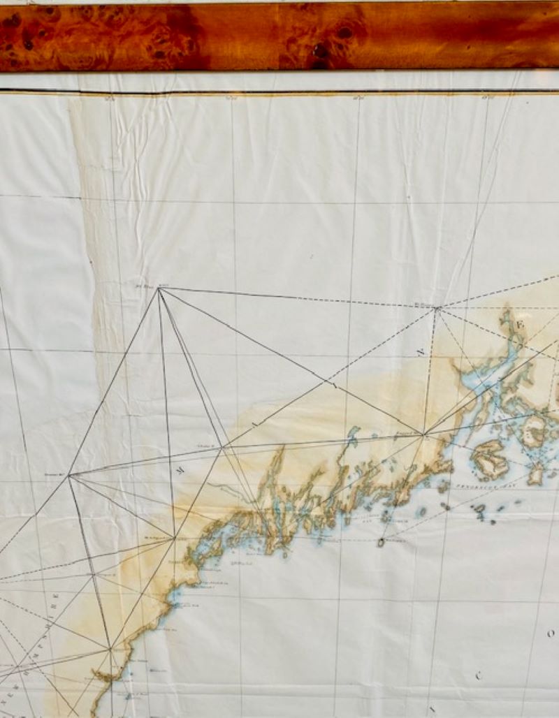
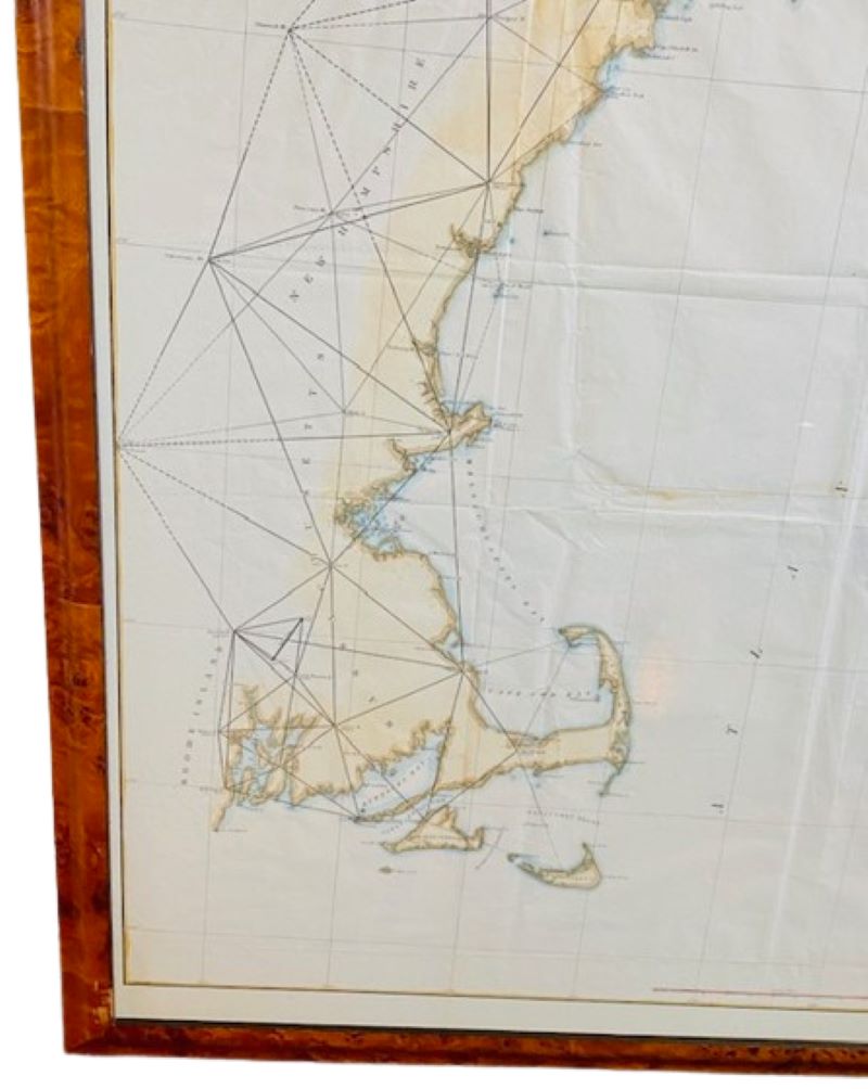
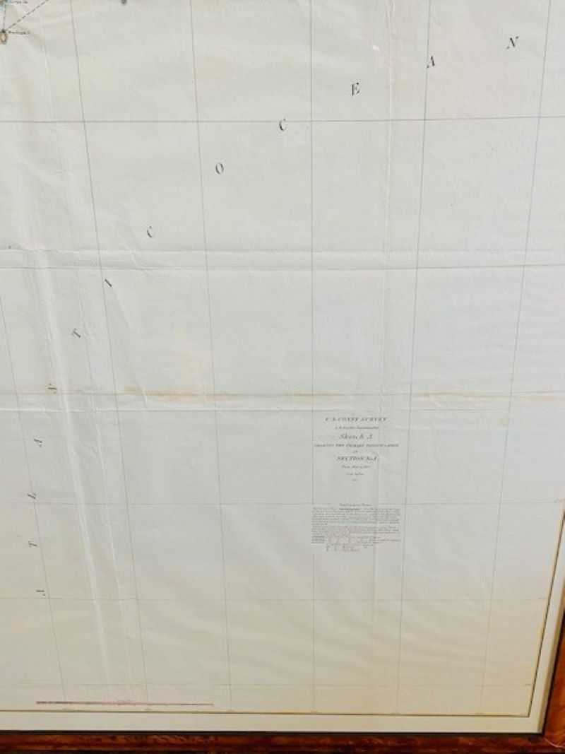
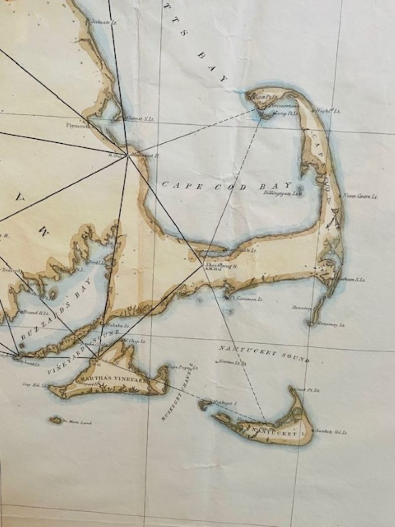
19th Century Chart of New England Coast: the U.S. Coast Survey Sketch A – Section 1, a triangulation chart showing the progress of the survey and details along the New England coastline from Nantucket to Passamaquoddy Bay, published in 1847.
In stock
19th Century Chart of New England Coast: the U.S. Coast Survey Sketch A – Section 1, a triangulation chart showing the progress of the survey and details along the New England coastline from Nantucket to Passamaquoddy Bay, published in 1847. This is a scarce transitional chart updated and republished over a short number of years prior to the final completed coast survey. Hand-colored at a later date and recently mounted in bird’s eye maple frame.
Excellent condition.
Measures: 36 in H x 31-1/4 in W